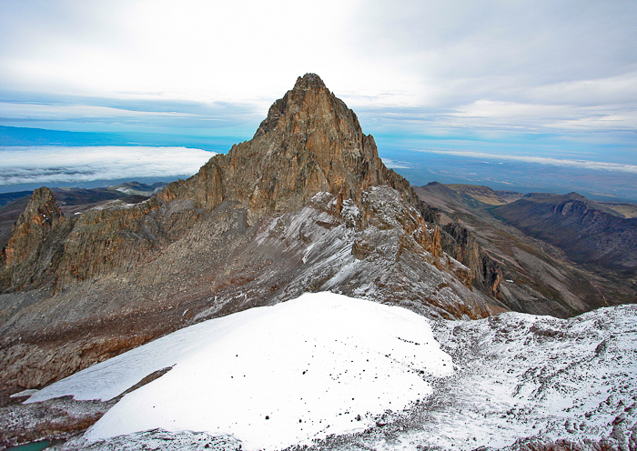
If you have ever stood in the foothills of Mount Kenya and looked in wonder at its peaks, this is what it is like from closer up – this shot was taken from a helicopter on a trip around the mountain.
We had ascended from the north and having reached the peaks, circled them anti-clockwise.
For this shot we were south-east of Nelion, (5,188 metres (17,021 ft)) the the lower of the two peaks – Batian, the higher (5,199 metres (17,057 ft)) is hidden behind it.
In the foreground is the Lewis Glacier, the largest on the mountain, although like the others it is getting smaller – it is estimated that there will be no more glaciers up there within 30 years.
To the left of the glacier at the bottom left of the image is a tarn called the Curling Pond. This is at 4790 metres (15715 ft)), from which data you get a handle on the scale of the image.
Mr Wikipedia has this to say (in part) about the mountain (but for more, google Mount Kenya and you will find a wealth of info):
Mount Kenya is the highest mountain in Kenya and the second-highest in Africa, after Kilimanjaro. The highest peaks of the mountain are Batian (5,199 metres (17,057 ft)), Nelion (5,188 metres (17,021 ft)) and Point Lenana (4,985 metres (16,355 ft)). Mount Kenya is located in central Kenya, just south of the equator, around (150 kilometres (93 mi)) north-northeast of the capital Nairobi. Mount Kenya is the source of the name of the Republic of Kenya.
Mount Kenya is a stratovolcano created approximately 3 million years after the opening of the East African rift. It was covered by an ice cap for thousands of years. This has resulted in very eroded slopes and numerous valleys radiating from the centre. There are currently 11 small glaciers. The forested slopes are an important source of water for much of Kenya.
There are eight vegetation bands from the base to the summit. The lower slopes are covered by different types of forest. Many species are endemic to Mount Kenya such as the lobelias, the senecios and the rock hyrax. An area of 715 square kilometres (276 sq mi) around the centre of the mountain was designated a National Park and listed as a UNESCO World Heritage Site in 1997. The park receives over 15,000 visitors per year.
Image taken on a Canon 40D with a Canon EFS 10-22 mm lens at 10mm; ISO 400 f4 1/1000


